
Its archipelagic structure has always been a marvel within the Pacific blue—a string of islands forming a silhouette of what could be a baby extending its hands, trying to unfurl his legs for the first step. The many-island cluster, more than 7,000 of them, forms a piece of a puzzle that doesn’t seem to lock, at least visually, with the jagged edges of the Asian continent. Whether Pangea chose to let chunks of geographical wonders adrift, or let them rise from the trenches deep, one will never know. But the country’s current formation, a fragment of a gargantuan past, stirs a global desire for discoveries, thanks to many unexplored islands that look like speckles from man’s map.
Scenic Panorama of a strait in the Hundred Islands National Park in Pangasinan, image by Roman Skorzus
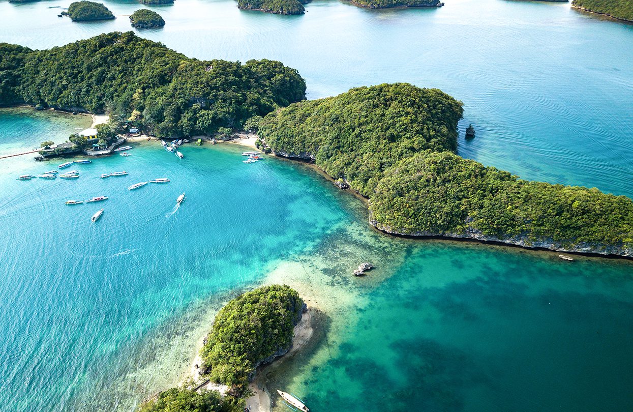
Lingayen Gulf, a tranquil body of bright azure waters, beautifully frames the Ilokano province of Pangasinan and blessed it with a collection of green-topped dollops floating over the shore. This is the Hundred Islands National Park, a name that causes either a fascination or a frown–surely, Mother Nature wouldn’t sprinkle ten tens of islands in a single area. This might come as a surprise: she didn’t. In fact, she blessed it with 123. 124, during low tide.
Crystal clear water of Hundred Islands in Alaminos City, image by Aragorn_19
The locals call them kapulo-pulo—small, mushroom-shaped lands gorgeously smothered with lush vegetation around its shapely head. Underneath it, a craggy limestone base, whose foundations may have eroded during millennia of rippling tides as not all of them had names.
 The doorway to Hundred Islands is Baranggay Lucap, a hearty, sandy fringe to the city of Alaminos. Boats are parked on the pearl-green waters before jetting to a glorious maze of tree-topped cliffs, with tour guides constantly entertaining their guests with folktales amidst the sound of the boat motor. Many of the Filipinos are superstitious folk; many of their myths still haunt the present generation–most outstandingly, those imbibed with romance. In one version, the Hundred Islands was formed when a magical pearl shattered into pieces, caused by two lovers claiming the hand of a princess. In another, the islands were tears from a broken-hearted giant.
Kayaking by a beautiful island beach in the Hundred Islands, image by Edwin Verin
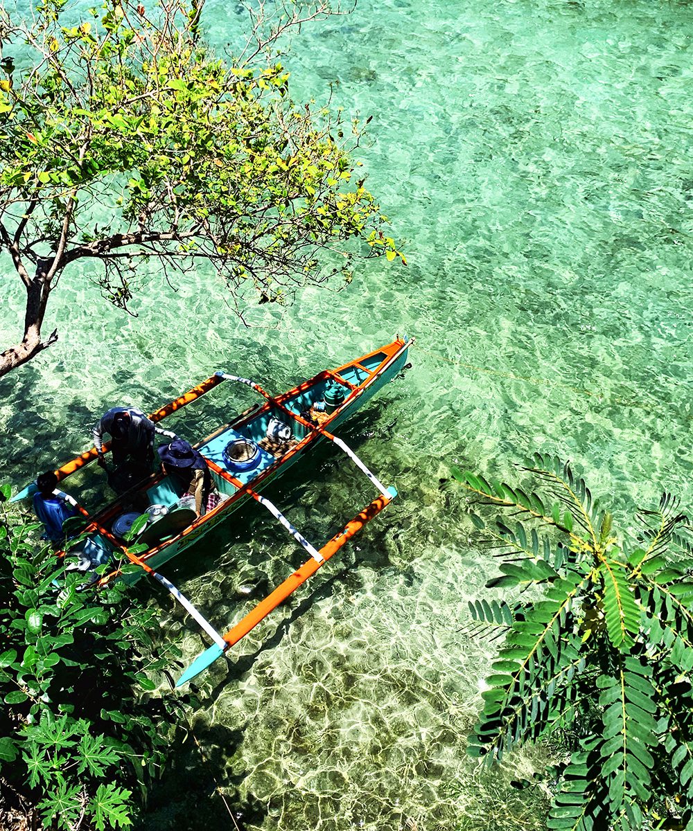
Quezon Island, a string of three islets clumped into one, is among the most visited venues, lodged with its own dining and grilling areas for the campers. Wooden decks lead as pathways to many leisure spots, including a resting area and a zipline. The beach grounds, a vibrant harmony of craggy rocks, green waters and powdery sand, beckons for swimming, snorkelling, and kayaking. Two of the other developed islands are Governor Island, which possesses the highest vantage point in the region, and Children Island, a swimming ground created perfectly for the younger explorers.
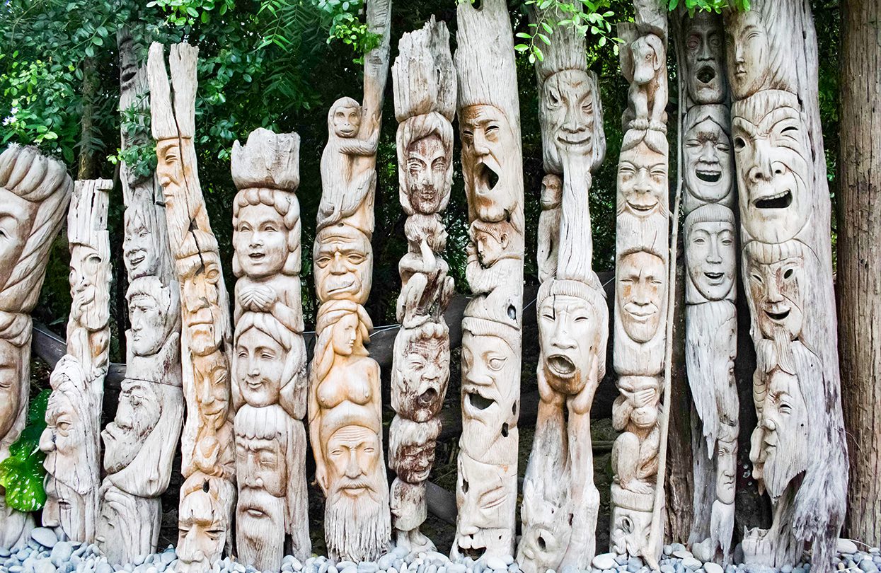
Wood carved with different faces line in a row to form a fence, Kamay na Bato Art and gallery in Luna La Union, image by Chema Grenda
How the tour guides spot the islands from beneath the limestone skirts is still a mystery, but despite looking almost similar, these rocky cliffs possess their own individual surprises. Marcos Island is a stretch of fine-powdered beaches and is home to the Imelda Cave, where one can dive from the ceiling and head straight into the borderless sea. Cathedral Island is named after a gigantic cave shaped like a basilica’s dome. Century Island is a jagged terrain of stalactites and stalagmites, with fruit bats thriving in the dark of its limestone corners, a perfect location to test the most skilful spelunker.
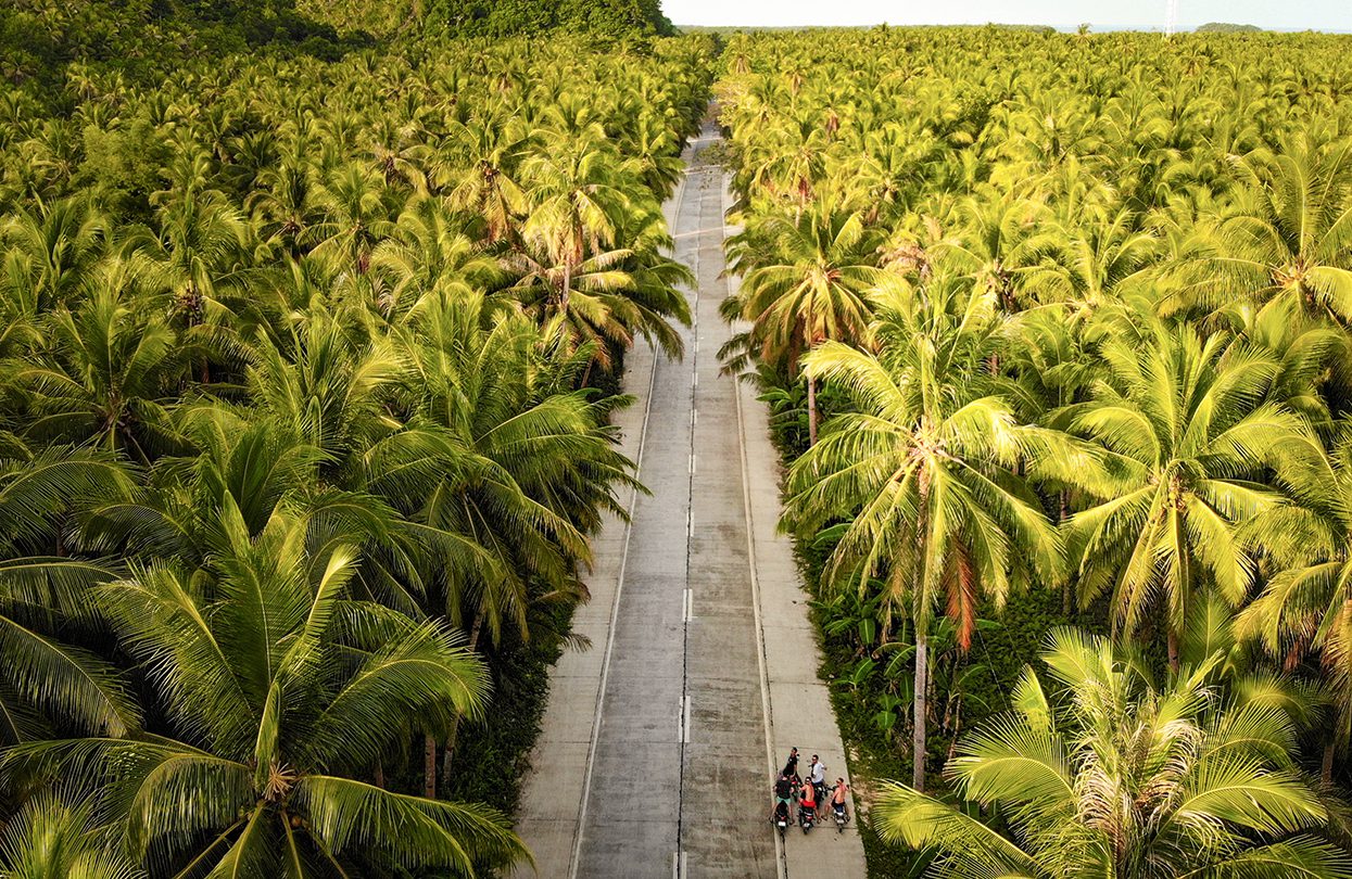
Palm Tree Road at Siargao, image by Stephen Green-Price
The Bicol region of Caramoan also possesses the same wonder—although not as many islets. The jungle-caped peninsula, the gem of Camarines Sur, rose to celebrity status after serving as a backdrop to many international shows, including the U.S. and French editions of Survivor. Its remoteness is a factor; Caramoan is a two-hour plane ride from Manila. By road, it takes almost twelve hours. It was as if Mother Nature herself kept its distance from the crowd; the scattered islands, engulfed in electric blue waters, remain unspoiled by man’s hands.
Siargao Island, image by Stephen Green-Price
Navigating through the Caramoan Islands takes an entire day; many of those opportunities require climbing into the jagged surface or snorkelling through the teal waters. Tight water shoes, among other things, is essential. The journey begins on the shore, where a boat accommodates an exclusive crowd on tour, and in hospitable Filipino fashion, the crew entertains with a hilarious mix of jokes and myths. Many of these myths are associated with how the islands were named.
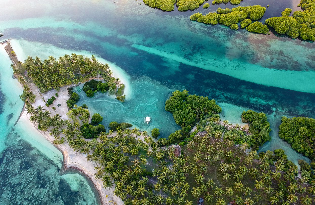
Hidden Paradise Cove With White Sand Beach and Lagoon – Tugawe, Caramoan, image by N8Allen
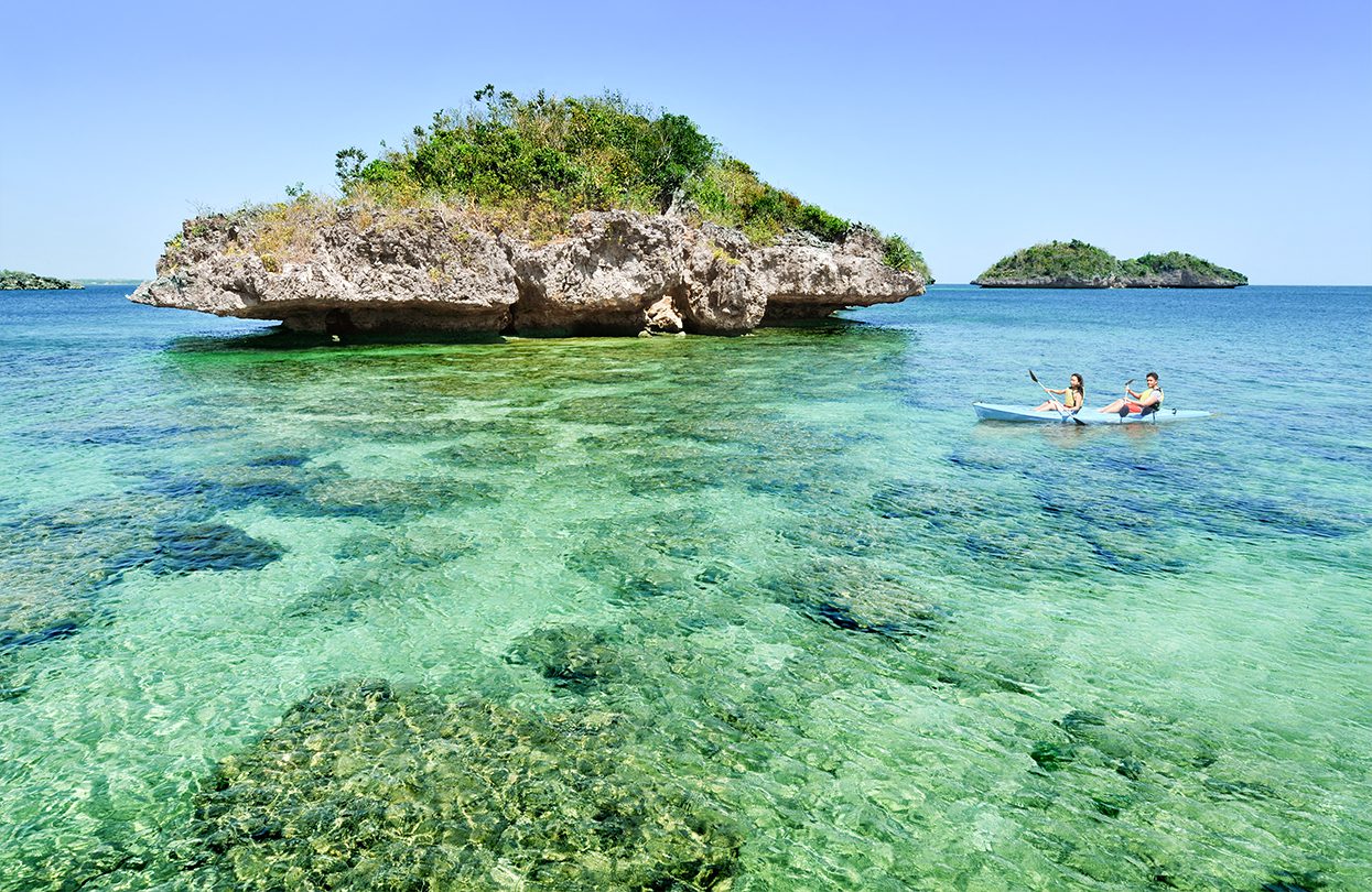
The island of Matukad, “steep climb” in Bicolano, challenges with a 10-minute ascent into the limestone path to catch a glimpse of its mysterious lagoon, one locals believe to be guarded by a magical Bangus—milkfish. Lahos, “passing through”, is a pristine white island nestled in between two limestone formations. This familiar spot has been an occasional shooting location for Survivor’s tribal council. Bag-ing, a triangle-shaped island with rock formations shaped like teeth, hides a preserved coral reef within its crystal-clear lagoon. One can snorkel in the depths and gaze into the lush marine life.
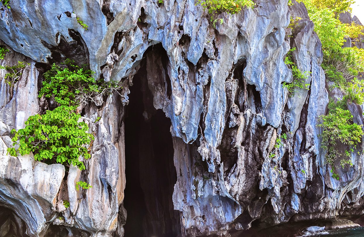
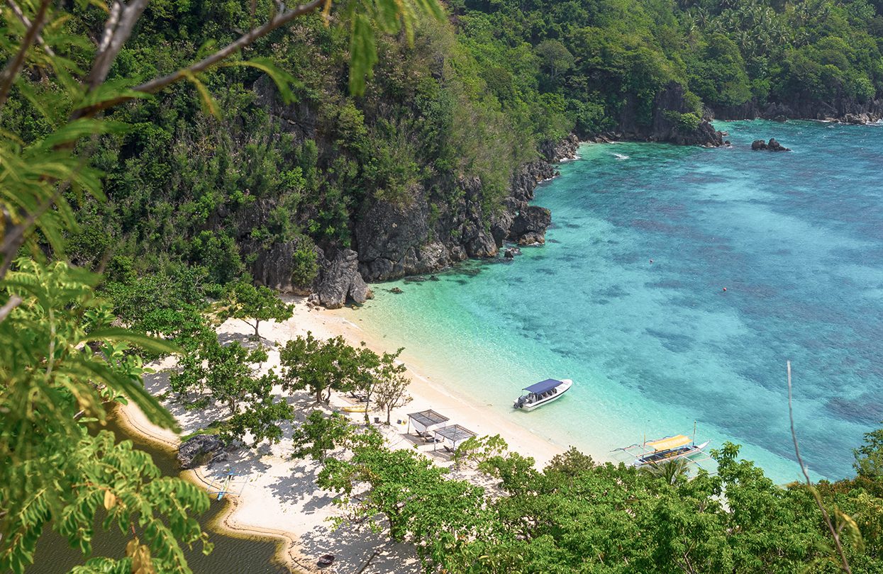
Cathedral Cave’ limestone rock formation – Pinasil Island, El Nido, Palawan, image by jejim
A photographic island that sinks during high tide, Cagbalinad is composed of receding limestone formations that offer unobstructed views of a more popular destination, the Gota Beach Cove. The more bucolic views are in Guinahoan, a peaceful lighthouse island laden with mangroves and flourishing livestock.
 From the region of Bisaya, down to Mindanao. Siargao has gained massive popularity as a surfing capital, annually challenging thrillists to face Cloud 9, one of the highly ranked surf breaks in the world. The waters are not tepid; they are curdled by the warm Philippine weather and the strong Pacific winds. Quicksilver, a smaller break on the shallow reef, sits just beside it.
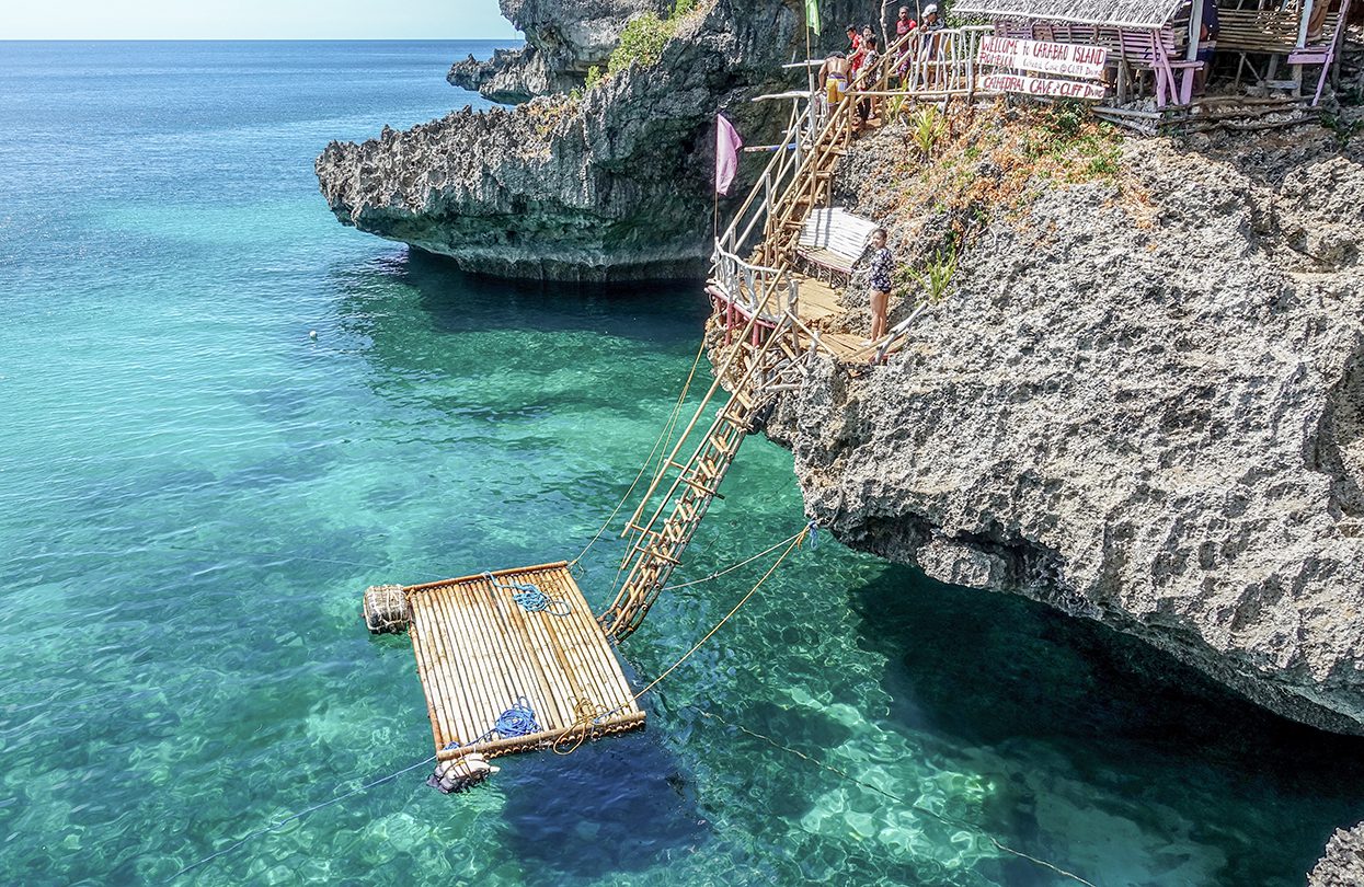
Cathedral Caverns and cliff diving in Boracay, image by Ravenash
But Siargao is more than its waves. The tear-shaped island is also a gateway to three spectacular islands spread across its wide blue channel. Naked Island, the first hop from the tour, is a bare patch of sand floating above a reef. There are no signs of life above it—not even a single tree to hide from the sun—but underneath, it brims with marine biodiversity, making it a perfect spot for snorkelling.
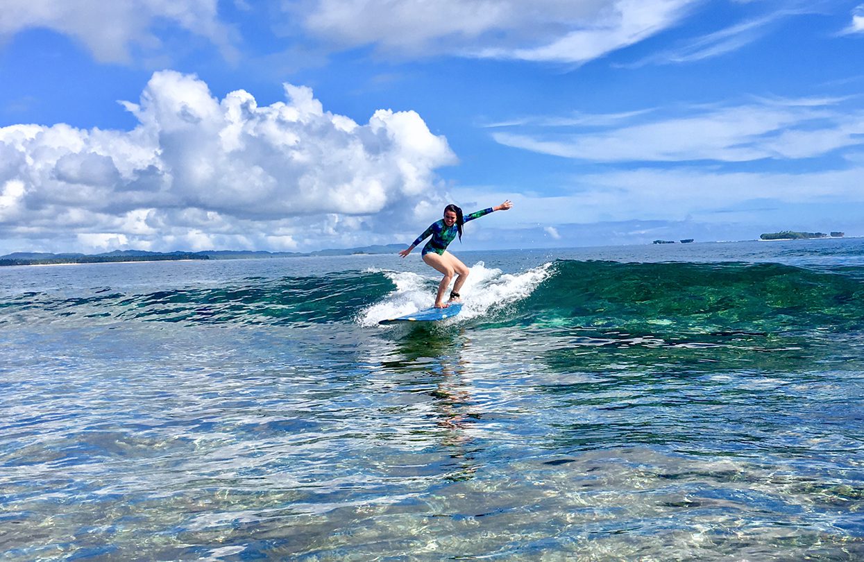
Surfing in Siargao, image by Ruby Ann Fuentes
A 20-minute ride from Naked Island, Daku appears—an abundant island extravagantly laden with coconut trees from edge to edge. Black-roofed huts parade by the beach, offering a place of rest before the next journey. This sight is echoed in the final venue, Guyam, a small island furnished with a generous cluster of coconut trees, sprouting from the white sand beach. Underneath its skirts, a shallow reef. A capable guide can climb the trunk and produce fresh juice from hand-picked coconuts. For a moment, one can submit into the vibe, gazing at the crystal blue lagoon and admiring its depths, wondering what secrets it holds.
With thousands of islands thriving in its sun-soaked waters, a great part of the Philippines remains a puzzle—unspoiled and unexplored. Veiled by the waters, these islands remain a secret, except for those who are not afraid to voyage far. ◼
Subscribe to the latest edition now by clicking here.
© This article was first published in Feb-Mar 2020 edition of World Travel Magazine.


